

2012 was the year that I just had to find where my 4x great grandfather Peter Wetzel lived in 1860. Based on the census records, this was the same farm that the Wetzel family lived 10 years prior. Could this also have been where my 3x great grandfather Henry was born? I searched…and searched…I spent so many hours scouring through records and microfilm but I wasn’t coming up with anything but I was not about to give up.
While preparing for a trip back up to Northumberland County to go cemetery hopping, I did a quick search for township maps for the county to help me get around (sometimes maps are just the preferred method over a GPS). A few clicks later I was looking at an 1858 land owner’s map of Jordan Township and there it was in flashing neon “P Weitzel”. Oh, but how could I be certain this was my Peter? The map showed the landowners and the Federal Census lists the “Value of Real Estate owned” so let’s compare. Ha…his neighbors match up! I found Peter’s home…at least on this roadless, streetless map from 1858.

1858 Jordan Township land owner’s map
Luckily, I have been using the U.S. Geological Survey’s website www.usgs.gov for quite a few years so I immediately used their site to pull up a map of the general area. From there it was a matter of matching up natural and man-made features to find the right location. I actually got really lucky with this as the nearby features were the same then and now but the nice feature was the line of Troutman owned houses in 1858 with was easily found on the current day map as Troutman Lane. I now knew the exact location of the farm my family owned so many years ago.
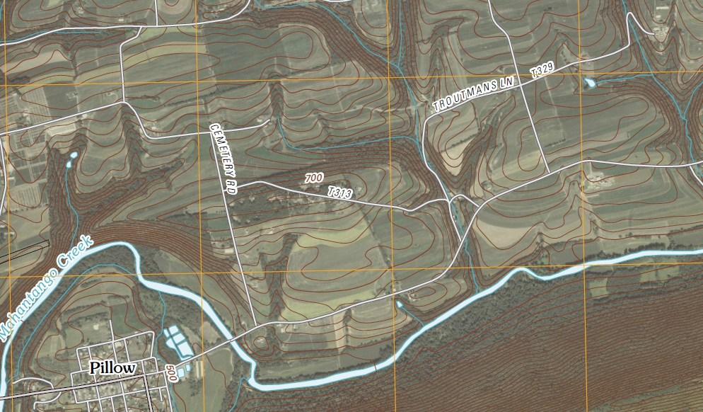
2010 USGS street/topo map
Now you didn’t think I was going to be in that general area and pass up tracking this farm down now did ya? Once the coordinates were in the GPS it was not only easy to find but it was also exactly where I thought it would be based on the maps. What to do once there…uh, knock on the door?
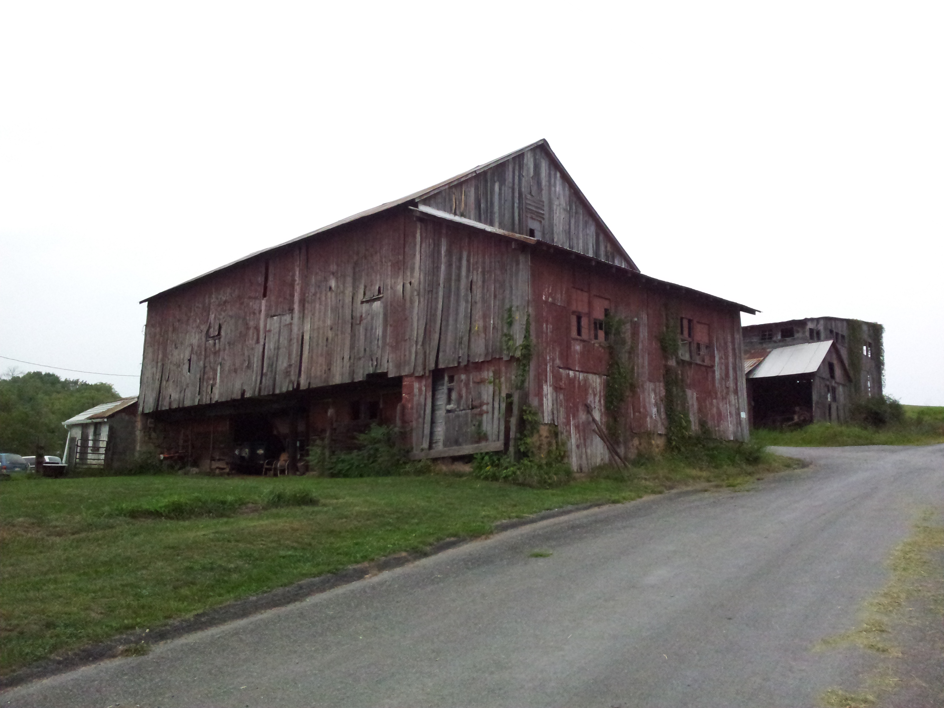
Original barn and outbuilding in background
It turns out that the property was purchased from my ancestors by the current owners ancestors…how cool is that! For an hour and a half they shared with me all they knew about the property, the buildings (two of which are original), the area as well as local cemeteries I may find my family buried. Before leaving, they invited me to look around and take some pictures.
I am so thankful that someone thought to make these maps in 1858 and that others have protected them and made them available to others over the past 155 years.
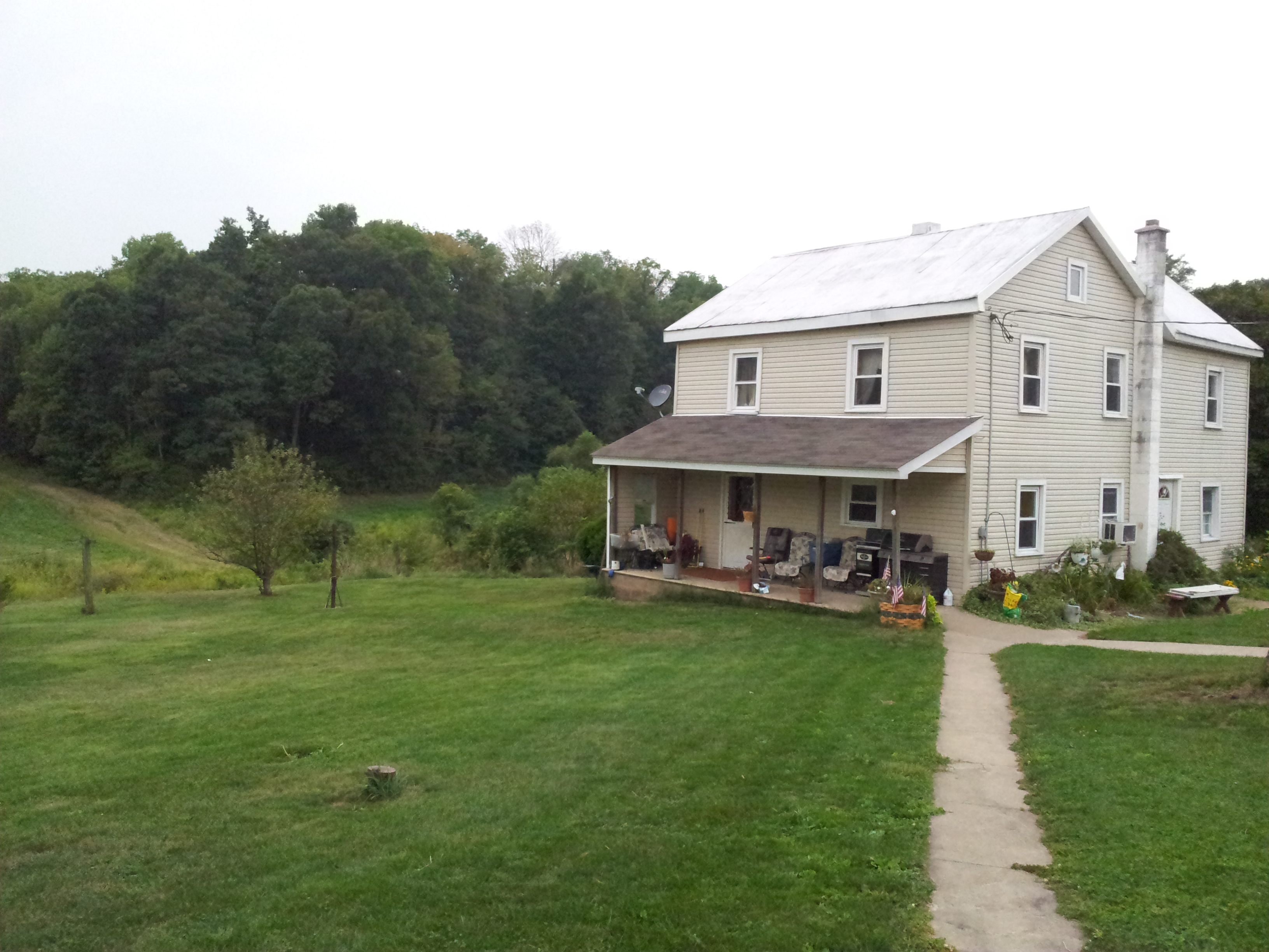
The original house is underneath some nice upgrades.
Map source: 1858 Jordan Township map, http://ancestortracks.com/; 2010 road/topo map, http://www.usgs.gov
Share this:

Filed under: Maps, Northumberland County, Online Resources, Wetzel | Tagged: Jordan Township, Mappy Monday, Photos | 1 Comment »

You must be logged in to post a comment.